St Helena Bay is a large bay in the Western Cape approx. 80NM north of Cape Town and 35NM north of Saldanha Bay. The Sandy Bay harbor is around Shelly Point and faces east.
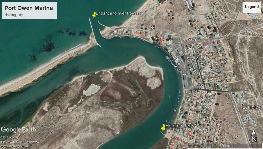
Eight miles further to the east, is the Berg River which leads to the sheltered Port Owen and is probably the best spot on the South African coast to spend the winter months. It makes an ideal departure port from SA.
Caution is advised at the Berg River entrance, as storm fronts with a large swell will likely result in breaking waves.
Vessels approaching from the North heading to the breakwater at the entrance should note there is a shallow bar at a depth of 1.5m LAT from 0.5NM out from the breakwater walls. It is advisable to enter at half tide.
32°44'34"S, 18°01'23" E (Sandy Point)
32° 47'029"S, 18° 08'908"E (Port Owen)
Leave a comment
You must Login or Register to submit comments.
Posted on behalf of Evan Gatehouse & Diane Selkirk:
We just hauled our 40′ catamaran at Port Owen boatyard. Couldn’t have had a better experience. Cheap, especially for a catamaran. Many places in South Africa want to haul catamarans on the bridge deck on rudimentary trailers, which we are not keen to do.
The manager, Frank, was super helpful and lent us his car to go grocery shopping and fill fuel jugs. We made free use of the office wifi while hauled out. The local Yacht club had showers at reasonable cost and meals available on 2 nights a week. Labour was very economical to sand and paint the boat if requested. We really recommend this boatyard.